What You'll Learn
Master advanced remote sensing techniques. Learn to analyze high-resolution imagery, extract detailed information, and apply advanced image processing algorithms.
Course Benefits
Industry Certification
Internationally recognized qualification
Expert Instructors
Learn from industry professionals
Dedicated Support
Assistance during and after training
Practical Skills
Apply knowledge immediately

Course Overview
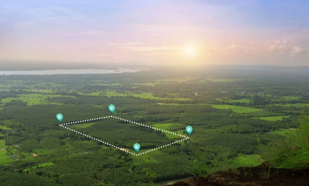
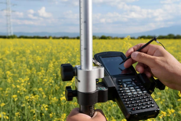
FeaturedThis course provides an in-depth understanding of advanced remote sensing techniques and their applications in various fields, including environmental monitoring, agriculture, urban planning, and disaster management. Participants will explore the latest technologies, data processing methods, and analytical tools used in remote sensing. The course covers both theoretical concepts and practical applications, enabling participants to analyze and interpret remote sensing data effectively. By the end of the course, participants will be equipped with the skills necessary to implement advanced remote sensing techniques in real-world projects.
Course Duration
5 Days
Who Should Attend
- Remote sensing professionals
- Environmental scientists
- Geospatial analysts
- Researchers in spatial and environmental sciences
- GIS specialists
- Advanced undergraduate or graduate students in related fields
Course Impact
Organisational Impact
-
Strengthens organisational capacity to monitor forest ecosystems accurately and efficiently.
-
Supports sustainable forest management by providing data-driven insights on vegetation health, forest cover, and change detection.
-
Enhances compliance with conservation policies, climate change commitments, and international forestry standards.
-
Reduces costs and time spent on field surveys by integrating remote sensing technologies.
-
Builds institutional resilience by equipping teams with tools for early detection of forest degradation and deforestation.
Personal Impact
-
Equips participants with specialized skills in applying remote sensing to forest monitoring and conservation.
-
Expands career opportunities in forestry, environmental science, and conservation-related fields.
-
Builds confidence in using satellite imagery and data analysis for practical decision-making.
-
Enhances technical expertise in vegetation analysis, forest health assessment, and land cover change monitoring.
-
Fosters the ability to contribute meaningfully to sustainable forestry and environmental protection initiatives.
Course Objectives
By the end of this course, participants will be able to:
- Understand the principles and advanced concepts of remote sensing.
- Apply advanced data processing and analysis techniques to remote sensing data.
- Utilize remote sensing for environmental monitoring and assessment.
- Integrate remote sensing data with GIS for enhanced spatial analysis.
- Implement remote sensing techniques in specific applications such as agriculture, urban planning, and disaster management.
Course Outline
Module 1: Introduction to Advanced Remote Sensing Technologies
- Overview of advanced remote sensing platforms and sensors
- Differences between optical, radar, and lidar systems
- Innovations in satellite and aerial remote sensing technologies
Module 2: High-Resolution and Hyperspectral Remote Sensing
- Fundamentals of high-resolution imaging
- Introduction to hyperspectral remote sensing and its applications
- Data acquisition, processing, and analysis techniques for high-resolution and hyperspectral data
Module 3: Advanced Image Processing Techniques
- Techniques for image fusion and enhancement
- Advanced classification methods and algorithms
- Change detection and anomaly detection using remote sensing data
Module 4: Data Integration and Interpretation
- Integrating remote sensing data with GIS and other spatial datasets
- Techniques for multi-source data fusion and analysis
- Interpretation of remote sensing data for environmental and spatial applications
Module 5: Real-World Applications and Case Studies
- Case studies of remote sensing applications in various fields (e.g., environmental monitoring, urban planning, disaster management)
- Practical exercises and projects involving real-world data
- Evaluation and presentation of remote sensing solutions to complex problems
Prerequisites
Course Administration Details
Customized Training
This training can be tailored to your institution needs and delivered at a location of your choice upon request.
Requirements
Participants need to be proficient in English.
Training Fee
The fee covers tuition, training materials, refreshments, lunch, and study visits. Participants are responsible for their own travel, visa, insurance, and personal expenses.
Certification
Upon successful completion of this course, participants will be issued with a certificate from Ideal Workplace Solutions certified by the National Industrial Training Authority (NITA) under License NO: NITA/TRN/2734.
Accommodation
Accommodation can be arranged upon request. Contact via email for reservations.
Payment
Payment should be made before the training starts, with proof of payment sent to outreach@idealworkplacesolutions.org.
For further inquiries, please contact us on details below:
Email: outreach@idealworkplacesolutions.org
Mobile: +254759708394
Register for the Course
Select a date and location that works for you.
In-Person Training Schedules
January 2026
| Date | Days | Venue | Fee (VAT Incl.) | Register |
|---|---|---|---|---|
| 5 Jan - 9 Jan 2026 | 5 days | Nairobi, Kenya | KES 99,000 | USD 1,400 | Enroll Now |
| 5 Jan - 9 Jan 2026 | 5 days | Cape Town, South Africa | USD 3,500 | Enroll Now |
| 5 Jan - 9 Jan 2026 | 5 days | Dubai, United Arabs Emirates | USD 4,000 | Enroll Now |
| 5 Jan - 9 Jan 2026 | 5 days | Zanzibar, Tanzania | USD 2,200 | Enroll Now |
| 12 Jan - 16 Jan 2026 | 5 days | Mombasa, Kenya | KES 115,000 | USD 1,500 | Enroll Now |
| 12 Jan - 16 Jan 2026 | 5 days | Kigali, Rwanda | USD 1,800 | Enroll Now |
| 12 Jan - 16 Jan 2026 | 5 days | Accra, Ghana | USD 5,950 | Enroll Now |
| 12 Jan - 16 Jan 2026 | 5 days | Kampala, Uganda | USD 2,200 | Enroll Now |
| 19 Jan - 23 Jan 2026 | 5 days | Dar es Salaam, Tanzania | USD 2,000 | Enroll Now |
| 19 Jan - 23 Jan 2026 | 5 days | Johannesburg, South Africa | USD 3,100 | Enroll Now |
| 19 Jan - 23 Jan 2026 | 5 days | Nakuru, Kenya | KES 105,000 | USD 1,400 | Enroll Now |
| 19 Jan - 23 Jan 2026 | 5 days | Dakar, Senegal | USD 3,500 | Enroll Now |
| 26 Jan - 30 Jan 2026 | 5 days | Pretoria, South Africa | USD 3,100 | Enroll Now |
| 26 Jan - 30 Jan 2026 | 5 days | Kisumu, Kenya | KES 105,000 | USD 1,500 | Enroll Now |
| 26 Jan - 30 Jan 2026 | 5 days | Naivasha, Kenya | KES 105,000 | USD 1,400 | Enroll Now |
| 26 Jan - 30 Jan 2026 | 5 days | Arusha, Tanzania | USD 2,000 | Enroll Now |
USD 1,400
Request Custom Training
We offer customized training solutions tailored to your organization's specific needs:
- Training at your preferred location
- Customized content to address your specific challenges
- Flexible scheduling to accommodate your team
- Cost-effective solution for training multiple employees
Early-bird Offer
Special pricing ends in:
Recent Activity
Additional Options
Customize your training experienceFrequently Asked Questions
Find answers to common questions about this course
You May Also Be Interested In
Explore more courses in this category
 Foundation
Training on Spatial and Spectral Data Fusion: Techniques for Enhanced Remote Sensing Analysis
Elevate your remote sensing skills. Our training equips you with techniques to f...
 Advanced
Training on Sensor Integration and Geosensing for Advanced Remote Sensing Applications
Gain advanced skills in sensor integration and geosensing to enhance remote sens...
 Intermediate
Training on GIS Mapping and Spatial Analysis for Energy
Gain practical skills in using GIS for energy planning, renewable resource mappi...
 Intermediate
Training on Field GIS & Mobile Data Collection (Survey123, FieldMaps & ODK)
Learn how to design, deploy, and manage mobile data collection systems using Sur...
Foundation
Training on Spatial and Spectral Data Fusion: Techniques for Enhanced Remote Sensing Analysis
Elevate your remote sensing skills. Our training equips you with techniques to f...
Advanced
Training on Sensor Integration and Geosensing for Advanced Remote Sensing Applications
Gain advanced skills in sensor integration and geosensing to enhance remote sens...
Intermediate
Training on GIS Mapping and Spatial Analysis for Energy
Gain practical skills in using GIS for energy planning, renewable resource mappi...
Intermediate
Training on Field GIS & Mobile Data Collection (Survey123, FieldMaps & ODK)
Learn how to design, deploy, and manage mobile data collection systems using Sur...
Training on Advanced Remote Sensing Techniques
Next class starts 5 Jan 2026

Subscribe to our Weekly Newsletter!
Get updates on the latest posts and more from Ideal Workplace Solutions straight to your inbox.
About Us
Take your career to the next level with our industry-leading training programs. Designed to build skills, boost confidence and drive success, we empower professionals like you to excel in your current role or explore new opportunities.
Quick Links