What You'll Learn
Course Benefits
Industry Certification
Internationally recognized qualification
Expert Instructors
Learn from industry professionals
Dedicated Support
Assistance during and after training
Practical Skills
Apply knowledge immediately

Course Overview
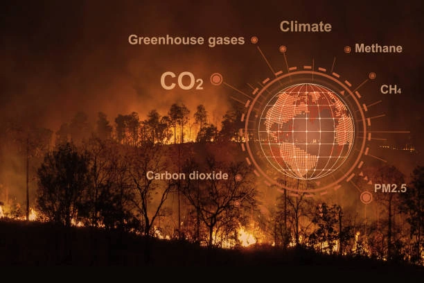
FeaturedThis training equips participants with skills to apply GIS and spatial analysis in designing, implementing, and strengthening early warning systems for disaster risk reduction, agriculture, health, and climate resilience. It emphasizes the use of geospatial data, mapping tools, and predictive modeling to improve preparedness, response, and decision-making in crisis and risk-prone environments.
Duration
5 Days
Who Should Attend
-
Disaster risk management and emergency response professionals
-
Climate change, environment, and agriculture specialists
-
GIS analysts and spatial data scientists
-
Government and NGO staff working in early warning and resilience
-
Researchers and consultants in risk monitoring and mitigation
Course Impact
Organizational Impact
-
Strengthened early warning systems through spatial intelligence
-
Improved decision-making for disaster preparedness and response
-
Better integration of GIS in project planning and monitoring
-
Increased credibility with donors through evidence-based reporting
Individual Impact
-
Hands-on GIS mapping and spatial analysis skills
-
Ability to integrate satellite and geospatial data into early warning models
-
Competence in developing visual risk maps and dashboards
-
Enhanced career opportunities in GIS, disaster risk management, and climate resilience
Course Objectives
By the end of this training, participants will be able to:
-
Understand the role of GIS in early warning systems.
-
Apply spatial data analysis for disaster and risk monitoring.
-
Use GIS software (QGIS/ArcGIS) for hazard mapping and vulnerability assessment.
-
Integrate remote sensing and satellite data into early warning models.
-
Develop geospatial dashboards for decision-making and response planning.
Course Outline
Module 1: Introduction to GIS in Early Warning Systems
-
Fundamentals of GIS and spatial data
-
Role of GIS in disaster risk reduction & resilience
-
Case Study: GIS applications in flood early warning
Module 2: Spatial Data Collection & Management
-
Sources of geospatial and hazard data
-
Remote sensing, satellite imagery, and open data platforms
-
Case Study: Using Earth observation data for drought monitoring
Module 3: GIS Mapping & Hazard Analysis
-
Hazard, vulnerability, and risk mapping
-
Spatial modeling and predictive analytics
-
Case Study: Mapping disease outbreaks with GIS
Module 4: Integration of GIS with Early Warning Systems
-
Building geospatial dashboards for decision-making
-
Real-time data visualization and alerts
-
Case Study: GIS-based cyclone and storm early warning systems
Module 5: Practical Applications & Sustainability
-
Designing GIS-supported early warning projects
-
Data ethics, security, and sustainability
-
Case Study: Community-based GIS early warning initiatives
Prerequisites
Course Administration Details
Customized Training
This training can be tailored to your institution needs and delivered at a location of your choice upon request.
Requirements
Participants need to be proficient in English.
Training Fee
The fee covers tuition, training materials, refreshments, lunch, and study visits. Participants are responsible for their own travel, visa, insurance, and personal expenses.
Certification
Upon successful completion of this course, participants will be issued with a certificate from Ideal Workplace Solutions certified by the National Industrial Training Authority (NITA) under License NO: NITA/TRN/2734.
Accommodation
Accommodation can be arranged upon request. Contact via email for reservations.
Payment
Payment should be made before the training starts, with proof of payment sent to outreach@idealworkplacesolutions.org.
For further inquiries, please contact us on details below:
Email: outreach@idealworkplacesolutions.org
Mobile: +254759708394
Register for the Course
Select a date and location that works for you.
In-Person Training Schedules
January 2026
| Date | Days | Venue | Fee (VAT Incl.) | Register |
|---|---|---|---|---|
| 5 Jan - 9 Jan 2026 | 5 days | Nairobi, Kenya | KES 99,000 | USD 1,400 | Enroll Now |
| 5 Jan - 9 Jan 2026 | 5 days | Cape Town, South Africa | USD 3,500 | Enroll Now |
| 5 Jan - 9 Jan 2026 | 5 days | Dubai, United Arabs Emirates | USD 4,000 | Enroll Now |
| 5 Jan - 9 Jan 2026 | 5 days | Zanzibar, Tanzania | USD 2,200 | Enroll Now |
| 12 Jan - 16 Jan 2026 | 5 days | Mombasa, Kenya | KES 115,000 | USD 1,500 | Enroll Now |
| 12 Jan - 16 Jan 2026 | 5 days | Kigali, Rwanda | USD 1,800 | Enroll Now |
| 12 Jan - 16 Jan 2026 | 5 days | Accra, Ghana | USD 5,950 | Enroll Now |
| 12 Jan - 16 Jan 2026 | 5 days | Kampala, Uganda | USD 2,200 | Enroll Now |
| 19 Jan - 23 Jan 2026 | 5 days | Dar es Salaam, Tanzania | USD 2,000 | Enroll Now |
| 19 Jan - 23 Jan 2026 | 5 days | Johannesburg, South Africa | USD 3,100 | Enroll Now |
| 19 Jan - 23 Jan 2026 | 5 days | Nakuru, Kenya | KES 105,000 | USD 1,400 | Enroll Now |
| 19 Jan - 23 Jan 2026 | 5 days | Dakar, Senegal | USD 3,500 | Enroll Now |
| 26 Jan - 30 Jan 2026 | 5 days | Pretoria, South Africa | USD 3,100 | Enroll Now |
| 26 Jan - 30 Jan 2026 | 5 days | Kisumu, Kenya | KES 105,000 | USD 1,500 | Enroll Now |
| 26 Jan - 30 Jan 2026 | 5 days | Naivasha, Kenya | KES 105,000 | USD 1,400 | Enroll Now |
| 26 Jan - 30 Jan 2026 | 5 days | Arusha, Tanzania | USD 2,000 | Enroll Now |
USD 1,400
Request Custom Training
We offer customized training solutions tailored to your organization's specific needs:
- Training at your preferred location
- Customized content to address your specific challenges
- Flexible scheduling to accommodate your team
- Cost-effective solution for training multiple employees
Early-bird Offer
Special pricing ends in:
Recent Activity
Additional Options
Customize your training experienceFrequently Asked Questions
Find answers to common questions about this course
You May Also Be Interested In
Explore more courses in this category
 Advanced
Training on Evaluation of Digital Health Interventions
Master evaluation of mHealth, telemedicine, and eHealth projects to improve deci...
 Intermediate
Training on Monitoring and Evaluation for Climate Change Adaptation Programs
Master monitoring and evaluation for climate change adaptation programs. Learn t...
 Intermediate
Training on Developing Monitoring and Evaluation Systems and Structures
Elevate your project's effectiveness. Learn to build M&E structures that ensure...
 Intermediate
Training on Talent for Data Quality and Integrity Checks in MEAL
Strengthen your organization’s MEAL systems with proven strategies for data qual...
Advanced
Training on Evaluation of Digital Health Interventions
Master evaluation of mHealth, telemedicine, and eHealth projects to improve deci...
Intermediate
Training on Monitoring and Evaluation for Climate Change Adaptation Programs
Master monitoring and evaluation for climate change adaptation programs. Learn t...
Intermediate
Training on Developing Monitoring and Evaluation Systems and Structures
Elevate your project's effectiveness. Learn to build M&E structures that ensure...
Intermediate
Training on Talent for Data Quality and Integrity Checks in MEAL
Strengthen your organization’s MEAL systems with proven strategies for data qual...
Training on GIS Mapping and Spatial Analysis in Early Warning Systems
Next class starts 5 Jan 2026

Subscribe to our Weekly Newsletter!
Get updates on the latest posts and more from Ideal Workplace Solutions straight to your inbox.
About Us
Take your career to the next level with our industry-leading training programs. Designed to build skills, boost confidence and drive success, we empower professionals like you to excel in your current role or explore new opportunities.
Quick Links